BRIN Researcher Details Wave Dynamics and Environmental Conditions Surrounding KM Virgo Transport 8 Incident in the Java Sea

The investigation into the tragic maritime incident involving the passenger and cargo vessel KM Virgo Transport 8 has entered a critical phase as scientific authorities release comprehensive oceanographic data regarding the disaster. Researchers from the National Research and Innovation Agency (BRIN) have meticulously analyzed the meteorological and hydrographic conditions prevailing at the exact time the vessel lost contact in the Java Sea. This scientific inquiry aims to shed light on the physical forces acting upon the ship during its fateful voyage from East Kalimantan to South Kalimantan, offering vital clues not only to the immediate cause of distress but also providing indispensable data to optimize ongoing search and rescue (SAR) operations for the remaining missing individuals.
According to the latest figures released by disaster management authorities and search teams, the human toll of the disaster remains significant. Out of the 243 individuals registered on board—comprising a mix of paying passengers, vessel crew members, and operational staff—114 people have been successfully accounted for as of Tuesday, September 15. Among those located, 108 individuals miraculously survived the ordeal and have received medical attention, while six victims were tragically recovered lifeless. Rescue teams, operating under challenging maritime conditions, continue an intensive around-the-clock search for the remaining 129 people still missing in the vast expanse of the open sea.
Chronology of the Voyage and Emergency Phase
The sequence of events leading to the deployment of massive search and rescue resources began on Saturday, September 12, when KM Virgo Transport 8 departed from the bustling port of Surabaya in East Java. The vessel was charted on a routine commercial maritime route crossing the Java Sea toward its final destination of Banjarmasin in South Kalimantan, a vital economic corridor connecting the nation’s most densely populated island to the sprawling resources of Borneo.
For the initial phase of the journey, navigation proceeded largely without public incident. However, the situation deteriorated drastically in the early hours of Sunday, September 13. At approximately 02:00 Central Indonesia Time (Wita), maritime authorities received reports that KM Virgo Transport 8 had officially lost all communications and failed to report its scheduled position check-ins. The sudden disappearance triggered an immediate emergency response, mobilizing vessels and aircraft from the National Search and Rescue Agency (Basarnas), the Indonesian Navy, the Marine Police, and commercial vessels operating in the vicinity.
As responders battled against time and oceanic elements to scan the suspected coordinates of the disappearance, maritime safety experts quickly realized that understanding the localized physical environment would be essential to predicting the drift patterns of survivors and debris. This realization prompted a rapid mobilization of BRIN’s Center for Climate and Atmosphere Research to reconstruct the marine weather and wave mechanics of the disaster zone.
Scientific Breakdown of Wave and Wind Conditions
Widodo Setiyo Pranowo, a senior researcher at BRIN’s Center for Climate and Atmosphere Research, revealed the empirical findings of the marine dynamics study during a formal press briefing. The analysis focused heavily on evaluating whether extreme sea states played a direct role in compromising the structural integrity or stability of the 119-meter-long vessel.
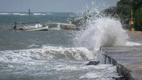
Addressing public speculation regarding severe weather, Dr. Pranowo clarified that while the waters were undeniably turbulent, the wave heights recorded at the time of the incident remained safely within the moderate classification rather than reaching catastrophic or extreme thresholds.
"The significant wave height was recorded at approximately 1.56 meters, with a wave period of about six seconds. Under the maritime safety classification utilized in this study, that value falls into the moderate category, which spans from 1.25 to 2.50 meters," Dr. Pranowo stated on Monday, September 14. He further elaborated that rough sea classifications typically begin when wave heights exceed 2.50 meters, while very high seas are designated when waves surpass the 4-meter mark.
Further dissecting the meteorological origins of the disturbance, the BRIN analysis determined that roughly 96 percent of the wave energy on the night of the incident was generated locally by direct surface wind action, rather than arriving as long-period swells originating from distant meteorological phenomena in the open ocean. Based on the specific wave characteristics and periods observed, surface wind speeds in the immediate vicinity of the vessel were estimated to range between 6.4 and 8.3 meters per second, translating to roughly 12 to 16 knots—a strength equivalent to forces 4 to 5 on the Beaufort scale.
Vessel Stability and Dynamic Response Analysis
A pivotal component of the BRIN investigation involved evaluating how these environmental forces interacted with the physical dimensions and hydrodynamic stability of KM Virgo Transport 8. The vessel, boasting an overall length of approximately 119 meters and a beam width of roughly 21 meters, encountered waves approaching from a southeasterly to easterly direction, equivalent to an angle of roughly 122 degrees.
Geometrically, this orientation meant that the waves struck the ship predominantly from the side, a dynamic maritime state known as beam seas. Navigational physics dictate that beam seas routinely induce repeated rolling motions as the vessel’s buoyancy attempts to adjust to the undulating water surface.
However, mathematical modeling of the ship’s dynamics discounted the occurrence of structural resonance—a dangerous phenomenon where matching wave and natural ship periods amplify rolling angles to catastrophic levels. The mathematical period of the incoming waves was calculated to be between 5.66 and 6.47 seconds, whereas the natural rolling period of a vessel with those specific dimensional parameters typically ranges between 11 and 18 seconds. This pronounced discrepancy between the two periods indicates that resonance amplification did not occur during the analyzed scenarios.
Further quantitative modeling estimated the vessel’s induced heel, or the degree to which it leaned away from the vertical axis due to wave action. Under standard operating conditions, the wave-induced tilt was projected at approximately 5.9 degrees, rising to between 11.2 and 11.9 degrees under peak wave loading moments. Meanwhile, wind contributions to the vessel’s list were calculated to account for less than half a degree.
Significantly, these figures remain far below the critical thresholds recognized in naval architecture. The estimated maximum heel angle of roughly 12 degrees sits safely under the critical 25-degree threshold, which is typically used in such studies as an early-warning indicator for seawater ingress via deck openings. More importantly, it remains exceptionally distant from the catastrophic 50- to 60-degree range where vessels generally lose their positive righting arm and capsize irreversibly.
Optimizing Search and Rescue Operations Using Oceanographic Data
Beyond reconstructing the immediate cause of the distress, the BRIN study yielded practical applications designed to directly enhance the ongoing joint SAR operations. In maritime disasters occurring in open tidal waters, accurately predicting where survivors, life rafts, and floating wreckage might drift is just as critical as locating the primary site of the accident.
Dr. Pranowo highlighted the critical role of the Stokes drift component—a net mass transport of water caused by surface gravity waves—which was estimated to contribute an average of 41.2 percent to the total surface current velocity in the search area. The research emphasized that search models failing to incorporate this wave-driven drift component risk generating heavily skewed trajectory estimates, potentially directing rescue assets far away from actual survivor clusters.
Compounding these movement variables, hydrographic data indicated that local currents at the incident site reverse directions in alignment with a standard 24-hour tidal cycle. Search commanders must continually update their operational grids from one tidal cycle to the next to maintain accuracy. Furthermore, the bathymetric profile of the seabed at the accident coordinates registers a depth of approximately 27 meters.
"This depth allows for structural surveys of the wreckage using advanced acoustic and robotic technology, including multibeam echosounders, side-scan sonar, remotely operated vehicles (ROVs), and specialized technical diving operations, strictly adhering to the standard operating procedures and legal authority of the teams leading the search and investigation," Dr. Pranowo concluded.
Broader Implications and Ongoing Response
The disappearance of KM Virgo Transport 8 has once again placed maritime safety protocols under intense public scrutiny across the Indonesian archipelago, a vast island nation heavily reliant on inter-island passenger ferries and cargo shipping. While scientific investigations by agencies like BRIN provide invaluable empirical data to reconstruct physical events, regulatory bodies such as the National Transportation Safety Committee (KNKT) and the Ministry of Transportation are expected to conduct comprehensive inquiries into human factors, cargo loading compliance, manifest accuracy, and vessel maintenance records.
As the search for the remaining 129 missing individuals enters its most critical window, federal authorities have urged patience and cooperation from families and the general public. The integration of advanced oceanographic forecasting, meteorological modeling, and hydrographic mapping demonstrates a growing reliance on scientific rigor in modern maritime disaster response. Ultimately, the lessons learned from the tragic sinking of KM Virgo Transport 8 will serve as a crucial benchmark for bolstering maritime safety standards, enhancing meteorological early-warning systems, and refining emergency coordination protocols across Indonesia’s vital commercial sea lanes.