How to Monitor Wildfire Smoke Distribution Using Digital Tools for Public Health and Safety

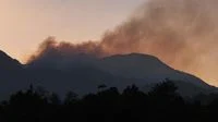
Forest and land fires (karhutla) remain a recurring environmental and public health challenge, generating not only hazardous hotspots but also dense smoke plumes that can traverse vast regional boundaries and international borders. The expansive movement of smoke necessitates continuous, real-time monitoring to enable communities, government bodies, and aviation authorities to anticipate adverse impacts on air quality, human health, and transport infrastructure. As technological capabilities advance, digital platforms and satellite imagery have become indispensable instruments for tracking these atmospheric pollutants, empowering the public to take proactive protective measures.
Understanding the trajectory and density of wildfire smoke is critical for recognizing potential environmental degradations before they severely affect populated centers. By utilizing dedicated digital services provided by meteorological agencies and international space programs, citizens and policymakers alike can access up-to-date visualizations of smoke dispersion. This data serves as a foundational element for issuing timely health advisories, planning emergency responses, and formulating long-term environmental policies aimed at mitigating the recurrence and severity of land fires during dry seasons.
The Significance of Monitoring Wildfire Smoke Distribution
According to guidelines and advisories issued by the Meteorology, Climatology, and Geophysical Agency (BMKG), tracking the movement of smoke resulting from forest and land fires yields multifaceted benefits. These range from safeguarding public health and ensuring aviation safety to advancing scientific understanding of climate dynamics and atmospheric pollution.
Protecting Public Health from Hazardous Pollutants
Smoke generated by biomass burning contains a complex mixture of particulate matter (such as PM2.5 and PM10), carbon monoxide, volatile organic compounds, and other noxious gases. When inhaled, these fine particles penetrate deep into the respiratory system and enter the bloodstream, triggering acute and chronic health conditions. Real-time information regarding smoke dispersion functions as an early warning system for vulnerable populations, including children, the elderly, and individuals with pre-existing respiratory or cardiovascular ailments. Armed with this knowledge, affected communities can implement protective measures, such as wearing certified respirators (e.g., N95 masks), sealing residential and commercial buildings, and curtailing outdoor physical activities to minimize exposure.
Safeguarding Aviation Operations and Transport Safety
Dense plumes of smoke severely restrict horizontal and vertical visibility, posing severe hazards to aviation safety. Pilots navigating through smoke-affected airspaces face compromised visual cues during takeoff, landing, and en-route navigation. Comprehensive tracking of smoke distribution enables air traffic controllers, airline operators, and aviation authorities to identify high-risk zones, adjust flight paths, issue localized warnings, and, when necessary, temporarily suspend operations at regional airports to prevent accidents.
Continuous Assessment of Regional Air Quality
Monitoring the physical spread of smoke allows environmental agencies to gauge the immediate degradation of air quality across different administrative regions. While ground-based air quality monitoring stations provide precise pollutant concentrations for specific locations, satellite-based smoke dispersion models fill spatial gaps, illustrating how plumes travel across districts and provinces. This comprehensive overview is vital for environmental ministries and local governments to declare air quality emergencies and implement targeted mitigation strategies.
Advancing Climate Research and Atmospheric Studies
Wildfire smoke significantly alters atmospheric chemistry and radiative forcing. Aerosols and black carbon suspended in the air absorb and scatter incoming solar radiation, which can influence regional weather patterns, cloud formation, and precipitation cycles. Continuous observation of smoke distribution provides climatologists and atmospheric scientists with empirical data required to study the profound feedback loops between rampant land fires and global or regional climate change.
Strengthening Empirical Research on Air Pollution
Data compiled from satellite tracking and dispersion mapping serves as a critical resource for academic and institutional studies focusing on air pollution dynamics. Researchers utilize these datasets to analyze seasonal pollution trends, identify primary source regions, measure pollutant longevity, and model the dispersion behaviors of particulate matter under varying meteorological conditions.
Informing Evidence-Based Public Policy
Government institutions rely on accurate environmental data to formulate robust public policies. Information regarding the frequency, scale, and movement of wildfire smoke offers policymakers quantifiable metrics to evaluate the effectiveness of existing environmental regulations, land-use policies, and fire prevention mandates. These insights can drive stricter enforcement against illegal slash-and-burn practices and prompt increased budgetary allocations for fire suppression infrastructure.
Enhancing Inter-Agency Fire Management and Response
Effective firefighting requires seamless coordination among multiple stakeholders, including disaster management agencies, forestry ministries, military units, and local governments. Smoke tracking data helps authorities pinpoint active fire zones, determine the origin of massive plumes, allocate firefighting resources strategically, and prioritize suppression operations in areas threatening human settlements or critical infrastructure.
Facilitating Proactive Evacuation and Emergency Preparedness
When smoke concentrations reach hazardous thresholds that threaten public safety, real-time distribution maps serve as vital references for disaster management teams planning large-scale evacuations. Knowing which corridors are clear of dense smoke ensures that evacuation routes remain safe and accessible for displaced populations moving away from fire-prone zones.
Digital Platforms for Tracking Wildfire Smoke
To access reliable, real-time data regarding forest fires and smoke dispersion, the public and researchers can leverage advanced digital platforms and satellite monitoring systems. Two primary tools widely utilized for this purpose are the official BMKG portal and the National Aeronautics and Space Administration (NASA) Fire Information for Resource Management System (FIRMS).
Utilizing the Official BMKG Website
The BMKG provides comprehensive meteorological, climatological, and geophysical information tailored to the geographical context of the region. Its digital infrastructure includes dedicated modules for monitoring extreme weather events and environmental hazards, including forest and land fires.
To access smoke distribution imagery via the BMKG website, users can follow a structured digital navigation process:
- Navigate to the official BMKG web portal using a secure browser.
- Select the main navigation menu designated for weather information.
- Locate and click on the specialized menu section dedicated to forest and land fire warnings (Peringatan Karhutla).
- Access the specific submodule featuring smoke dispersion imagery (Citra Sebaran Asap).
- Analyze the provided satellite visualizations to observe the density and trajectory of smoke plumes across various provinces and islands.
Users should note that digital interfaces and website layouts are subject to periodic updates and administrative restructuring. Therefore, individuals must ensure they are accessing data exclusively through verified, official BMKG channels to avoid misinformation.
Leveraging NASA FIRMS for Global Satellite Monitoring
For broader spatial analysis and high-resolution tracking of active fires, the NASA Fire Information for Resource Management System (FIRMS) offers unparalleled capabilities. NASA FIRMS distributes active fire data derived from advanced spaceborne sensors within hours of satellite observation.
The procedure to inspect fire activity and environmental conditions on NASA FIRMS involves the following steps:
- Access the NASA FIRMS web application through an internet browser.
- Open the layer management interface (Layers) located within the mapping environment.
- Choose appropriate satellite imaging layers, such as Moderate Resolution Imaging Spectroradiometer (MODIS) data collected from the Aqua and Terra satellites, or Visible Infrared Imaging Radiometer Suite (VIIRS) data gathered from the Suomi NPP and NOAA-20 satellites.
- Examine the interactive map to identify active thermal anomalies (hotspots) and observe surrounding environmental conditions.
To accurately identify smoke plumes, users can switch satellite imagery to true color or natural color viewing modes. However, distinguishing smoke from low-altitude clouds, morning fog, or other atmospheric phenomena can occasionally present challenges due to similar visual signatures in optical spectrums.
It is crucial to understand that NASA FIRMS primarily focuses on locating active thermal anomalies through satellite observation. The presence of a hotspot does not inherently define the exact geographic boundaries of a smoke plume or quantify the local concentration of air pollutants. Consequently, satellite data should be synthesized with ground-based air quality indices, meteorological forecasts, and official bulletins released by meteorological authorities to form a holistic assessment of environmental safety.
Analytical Implications of Satellite-Based Environmental Monitoring
The integration of digital satellite tools into daily disaster management marks a significant shift toward data-driven environmental governance. Historically, communities relied on retroactive reporting and delayed ground surveys to understand the magnitude of environmental crises. Today, orbital sensors provide continuous oversight, allowing preemptive measures to be deployed before smoke blankets densely populated metropolitan zones.
Nevertheless, relying solely on remote sensing data presents certain operational limitations. Atmospheric interference, cloud cover, and spatial resolution constraints can obscure subtle plumes or hinder precise pollutant measurement. Furthermore, satellite observations do not automatically translate public health directives; they require translation by health officials and meteorologists into actionable advice for everyday citizens.
Ultimately, while digital platforms like BMKG and NASA FIRMS furnish invaluable visibility into the sprawling impacts of forest and land fires, they function best as components of a comprehensive disaster risk reduction framework. By combining orbital insights with rigorous ground-level monitoring, public awareness, and stringent enforcement of environmental protection laws, societies can better navigate the recurring challenges posed by seasonal land fires and mitigate their long-term toll on human health and planetary stability.