
Tahoe Blizzard Snow Forecast
Tahoe Blizzard Snow Forecast: Detailed Analysis and Winter Outlook
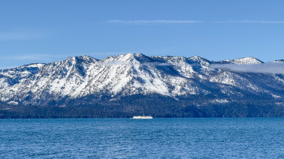
The Lake Tahoe region, a world-renowned destination for winter sports and breathtaking alpine scenery, is no stranger to significant snowfall. Understanding the nuances of a Tahoe blizzard snow forecast is crucial for residents, businesses, and visitors alike. This article provides a comprehensive analysis of factors influencing Tahoe’s winter weather, methods for interpreting snow forecasts, and a detailed outlook for the upcoming blizzard season.
Understanding Tahoe’s Microclimates and Weather Patterns
The Sierra Nevada mountain range, specifically the Tahoe basin, is characterized by complex microclimates influenced by elevation, proximity to the lake, and prevailing wind patterns. These factors create highly variable snow accumulations across different areas of Tahoe. For instance, western-facing slopes at higher elevations often receive more snow than eastern-facing lower elevations due to orographic lift, where moist air is forced upward by mountains, cools, and condenses to form precipitation. The massive surface area of Lake Tahoe itself also plays a significant role. During colder months, the lake can release moisture into the atmosphere, contributing to lake-effect snow, particularly when cold air masses move across the relatively warmer water. This phenomenon can lead to isolated, intense snowfall events in areas downwind of the lake.
Furthermore, the jet stream’s behavior is paramount in determining the intensity and frequency of winter storms impacting Tahoe. A strong, southward-dipping jet stream often directs moisture-laden storm systems directly into the Sierras, resulting in heavy snow. Conversely, a ridge of high pressure can steer storms away, leading to drier periods. Identifying the trajectory and intensity of the jet stream is a primary focus for meteorologists predicting blizzard conditions. The presence of "atmospheric rivers," narrow corridors of concentrated moisture in the atmosphere, can also be a precursor to extreme precipitation, including heavy snowfall in Tahoe. The interaction of these large-scale atmospheric patterns with the local topography creates the unique and often dramatic snowfall events characteristic of a Tahoe blizzard.
Key Indicators for a Tahoe Blizzard Snow Forecast
Predicting a full-fledged blizzard in Tahoe involves monitoring several key meteorological indicators. Foremost among these is the snowfall accumulation forecast. This is typically presented in inches or feet and is the most direct measure of anticipated snow. However, the timing and intensity of the snowfall are equally important. A forecast of 1-3 feet over 24 hours suggests a more impactful event than the same amount spread over 72 hours. Meteorologists analyze wind speed and direction forecasts meticulously. Blizzard conditions are officially defined by sustained winds of 35 mph or greater for at least three hours, accompanied by considerable falling or blowing snow that reduces visibility. Therefore, high wind forecasts are a critical component of a blizzard prediction.
Visibility reduction, often described as "whiteout conditions" or "near zero visibility," is another hallmark of a blizzard. This is driven by the combination of falling snow and strong winds picking up existing snow. Snowfall intensity, measured in inches per hour, is a critical indicator here. Forecasts for temperature at various elevations are also vital. Colder temperatures, particularly in the mid and upper atmosphere, favor snow over rain or sleet, especially at higher elevations. The dew point temperature is also important; when it’s below freezing, precipitation is almost certainly snow. The type of precipitation being forecast – whether it’s light, fluffy snow, heavy wet snow, or a mix with rain – significantly impacts accumulation and travel conditions. Finally, the duration of the storm is a key factor. Longer-lasting storms, even with moderate snowfall rates, can produce substantial accumulations and prolonged disruptive conditions. Understanding how these indicators combine and evolve is essential for interpreting the severity of a Tahoe blizzard forecast.
How Meteorologists Develop Tahoe Blizzard Forecasts
The development of a Tahoe blizzard snow forecast is a sophisticated, multi-layered process relying on a suite of advanced tools and expertise. At the foundation are global weather models, such as the Global Forecast System (GFS) and the European Centre for Medium-Range Weather Forecasts (ECMWF). These models, utilizing vast amounts of data from satellites, weather balloons, buoys, and ground stations, simulate atmospheric conditions across the globe. They provide initial forecasts for temperature, wind, pressure, and moisture at various atmospheric levels.
However, global models have limitations in capturing the fine-scale details of mountain weather. This is where mesoscale models, such as the North American Mesoscale Forecast System (NAM) and the High-Resolution Rapid Refresh (HRRR), come into play. These models have higher spatial resolution, allowing them to better depict the interaction of weather systems with the complex topography of the Sierra Nevada. They can provide more localized predictions for snowfall, wind gusts, and precipitation type. Meteorologists also employ ensemble forecasting. This involves running multiple versions of a model with slightly different initial conditions. The spread of the results from these ensemble runs provides an indication of the forecast’s certainty. A tight cluster of similar outcomes suggests higher confidence, while a wide spread indicates greater uncertainty.
Radar and satellite imagery are continuously monitored in real-time to track the progression of developing storms. Doppler radar can detect the intensity and movement of precipitation, while satellite imagery shows cloud cover, storm systems, and moisture plumes. Surface observations from weather stations across the Tahoe basin and surrounding areas provide crucial ground truth, allowing meteorologists to verify model predictions and make necessary adjustments. Finally, human forecaster expertise is indispensable. Experienced meteorologists analyze the output from various models, compare them with current observations, and use their understanding of local weather phenomena to refine the forecast, identifying potential biases in the models and highlighting critical weather events like blizzards. This iterative process of data assimilation, model interpretation, and expert judgment is what leads to the detailed Tahoe blizzard snow forecasts provided to the public.
Interpreting Snowfall Totals and Accumulation Zones
Snowfall totals in Tahoe are rarely uniform across the entire basin. Understanding accumulation zones is critical for planning. Higher elevations generally receive significantly more snow than lower elevations. Resorts like Palisades Tahoe (formerly Squaw Valley and Alpine Meadows), Heavenly Mountain Resort, and Northstar California typically see the highest accumulations. Forecasts often differentiate between summit accumulations and base area accumulations. A forecast of 2-4 feet at the summit might translate to 1-2 feet at the base, or even less in valley floors.
Windward vs. Leeward Slopes also play a significant role. Western-facing slopes, directly exposed to incoming Pacific storm systems, tend to experience heavier snow. Eastern-facing slopes, in the rain shadow of the Sierras, will often receive less. Proximity to Lake Tahoe can also create localized variations. Areas downwind of the lake during certain cold air outbreaks might experience enhanced snowfall due to lake-effect snow. When interpreting a forecast, look for specific mentions of areas expected to receive the most snow. Phrases like "heavy snow accumulations expected on west-facing slopes above 8,000 feet" provide valuable directional information. It’s also important to consider the density of the snow. A forecast of 3 feet of light, fluffy powder is very different from 3 feet of heavy, wet snow, which can cause significant structural stress and travel difficulties.
Timing and Duration of Blizzard Events
The impact of a Tahoe blizzard is not solely determined by the total snowfall but also by its timing and duration. A blizzard that dumps 2 feet of snow overnight is disruptive, but one that snows heavily for 36-48 hours with relentless winds and poor visibility presents a much more severe challenge. Meteorologists provide hourly or multi-hourly snowfall forecasts to indicate the intensity of the storm. Periods of "moderate to heavy snow" suggest higher snowfall rates (e.g., 1-3 inches per hour), which can quickly overwhelm road clearing efforts and significantly reduce visibility.
Wind intensity and duration are equally critical for blizzard conditions. Sustained winds of 35 mph or greater, combined with falling or blowing snow, lead to whiteout conditions and dangerous travel. Forecasts often specify peak wind gusts, which can be considerably higher than sustained winds. Prolonged periods of these strong winds can cause significant drifting, burying roads and creating impassable conditions, even after snowfall has ceased. Understanding the onset and cessation of the heaviest snowfall and strongest winds is vital. Will the storm hit during the morning commute? Will it abate just in time for weekend travel? These temporal aspects of the forecast are crucial for effective preparation and decision-making. The overnight hours are often when the most significant accumulations occur due to prolonged periods of uninterrupted snowfall and potentially less daytime warming contributing to melting.
Impacts of a Tahoe Blizzard on Travel and Infrastructure
A Tahoe blizzard has profound and far-reaching impacts on travel and infrastructure. Road closures are almost inevitable. Major highways, including U.S. Route 395, Interstate 80, and State Route 88, are frequently shut down due to heavy snow, whiteout conditions, and avalanche risk. Chain controls are almost always implemented, requiring vehicles to carry and use chains. Even with chains, travel can be extremely hazardous and slow. Many vehicles, especially those not equipped for winter conditions, may become stuck, further impeding traffic.
Airport operations at Reno-Tahoe International Airport (RNO) can be significantly affected, leading to flight delays and cancellations. Public transportation services within the Tahoe basin, including bus routes, will likely be suspended. For residents, power outages are a common concern. Heavy snow accumulating on power lines, coupled with high winds, can cause them to snap, leading to extended periods without electricity. This impacts heating, communication, and essential services. Emergency services face increased demand and operational challenges, with responders needing to navigate treacherous road conditions to reach those in need. Businesses, particularly ski resorts, can experience both positive and negative impacts. While a blizzard brings abundant snow and potential for increased visitor numbers once conditions stabilize, immediate impacts include closures, reduced staffing, and difficulties for employees reaching work. The overall economic activity can be significantly disrupted during the storm itself.
Preparing for a Tahoe Blizzard: Essential Steps
Effective preparation for a Tahoe blizzard is multifaceted and requires proactive measures. Vehicle preparedness is paramount. Ensure your vehicle has a full tank of gas, a functioning battery, good tires (preferably snow tires or all-season tires with adequate tread), and a comprehensive winter emergency kit. This kit should include blankets, warm clothing, water, non-perishable food, a first-aid kit, a flashlight with extra batteries, a shovel, sand or kitty litter for traction, and jumper cables. Regularly check your vehicle’s windshield wipers and ensure the exhaust pipe is clear of snow to prevent carbon monoxide poisoning.
Home preparedness involves stocking up on essential supplies. This includes non-perishable food for at least three days, potable water, medications, batteries for flashlights and radios, and alternative heating sources if you have them. Ensure you have a way to stay informed, such as a battery-powered radio or a charged mobile phone with power banks. Test your carbon monoxide detectors and smoke alarms. For personal safety, have a plan for staying warm and safe if power outages occur. Know how to shut off water mains if pipes are at risk of freezing. Keep pets indoors and ensure they have adequate food and water. Staying informed is crucial. Monitor reliable weather forecasts from sources like the National Weather Service (NWS), local news outlets, and official social media accounts of transportation departments and ski resorts. Heed all advisories, warnings, and orders from local authorities. Avoid unnecessary travel during the storm. If you must travel, inform someone of your route and expected arrival time.
Post-Blizzard Recovery and Snow Removal
The aftermath of a Tahoe blizzard presents its own set of challenges and requires coordinated recovery efforts. Snow removal is a massive undertaking. Public works departments in Tahoe’s various counties and municipalities deploy fleets of plows to clear main roads and essential access routes. However, the sheer volume of snow, coupled with drifting, can make this a time-consuming and arduous process. Homeowners are responsible for clearing their driveways and sidewalks. For those with mobility issues or elderly residents, community efforts or paid services are often utilized.
Avalanche control becomes a critical component of post-storm management, especially in mountainous areas. Resorts and transportation departments conduct controlled avalanches to mitigate the risk of natural slides. This often involves road closures in specific areas while the work is underway. Power restoration can take time, depending on the extent of the damage. Utility companies work diligently to repair damaged lines and restore service, but patience is often required. Insurance claims may be filed for property damage caused by the storm, such as roof collapse or damage from falling trees. It’s important to document any damage thoroughly. Finally, restoring normalcy involves clearing snow from public spaces, reopening businesses, and resuming essential services. Community resilience and cooperation are key to a swift and effective recovery from a significant Tahoe blizzard.
Long-Term Winter Outlook and Climate Considerations
While short-term blizzard forecasts are crucial for immediate planning, understanding the long-term winter outlook and broader climate considerations for Tahoe’s snowpack is essential. The El Niño-Southern Oscillation (ENSO) cycle significantly influences winter weather patterns in the Sierras. El Niño years are often associated with wetter and snowier conditions in Tahoe, while La Niña years can bring drier spells. Meteorologists closely monitor ENSO indicators to inform seasonal forecasts.
Climate change is also a growing factor. While individual storm events remain unpredictable, long-term trends suggest potential shifts in snowfall patterns. Some studies indicate a potential for warmer winters with more rain at lower elevations and a shorter snow season. However, other research suggests that while average temperatures may rise, the frequency and intensity of extreme winter storms, including blizzards, could still occur, albeit potentially with more variable timing and snow density. The Pacific Decadal Oscillation (PDO), another climate pattern, also influences long-term weather trends in the Pacific Northwest and can have a modulating effect on ENSO’s impact on Tahoe. Furthermore, the North Atlantic Oscillation (NAO) can sometimes influence storm tracks reaching North America. Staying informed about these larger climate drivers can provide a broader context for understanding Tahoe’s winter weather variability and the potential evolution of its blizzard season in the years to come. This integrated understanding of global climate patterns and regional microclimates is vital for forecasting the future of winter in this iconic mountain destination.
