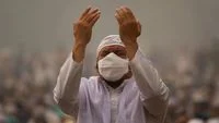
Comprehensive Guide to Monitoring Air Quality Amid Rising Environmental Hazards and Volcanic Eruptions

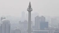
Monitoring real-time environmental conditions has become an essential public health practice for urban residents, communities near forest fires, and populations affected by volcanic activity. In an era marked by shifting climate patterns, industrial expansion, and frequent tectonic disturbances, understanding the purity of the air one breathes is no longer optional—it is a critical protective measure. When pollution levels surge due to urban congestion, seasonal agricultural burning, or sudden geological events such as volcanic eruptions, public health agencies universally advise citizens to check local air quality metrics before stepping outside. By staying informed about real-time atmospheric indices, individuals can make calculated decisions regarding outdoor activities, minimize exposure to hazardous particulates, and safeguard vulnerable demographics such as children, the elderly, and those with pre-existing respiratory conditions.
The Evolution of Accessible Air Quality Monitoring
For decades, assessing atmospheric conditions required specialized, expensive laboratory equipment operated exclusively by state environmental protection agencies or academic institutions. Daily reports were often delayed, generalized to broad metropolitan zones, and largely inaccessible to the average citizen. However, the proliferation of smartphone technology, satellite data integration, and low-cost sensor networks has revolutionized environmental transparency. Today, comprehensive air quality data is available instantly via mobile applications, web browsers, and integrated mapping services.
Governments and international meteorological organizations have increasingly democratized this information, recognizing that public awareness is the first line of defense against air pollution. When forest fires—often referred to locally as karhutla—break out across agricultural frontiers, or when stratovolcanoes spew ash plumes kilometers into the atmosphere, immediate data dissemination prevents mass hospitalizations and empowers communities to implement protective measures, such as wearing N95 respirators or sealing residential ventilation systems.
Primary Digital Tools for Checking Air Quality via Smartphone
Modern technology allows individuals to monitor atmospheric conditions with unprecedented precision. Several accessible platforms aggregate satellite observations, ground-based monitoring station feeds, and predictive meteorological models to deliver up-to-the-minute reports.
Google Maps Air Quality Integration
One of the most seamless ways to evaluate local conditions is through mainstream mapping technology. Google Maps incorporates a dedicated Air Quality feature that superimposes real-time data directly onto geographical maps. By enabling the air quality layer, users can view color-coded indices for their exact neighborhood or a designated destination. This data is synthesized from a combination of official government monitoring stations, low-cost sensor networks, and advanced atmospheric dispersion models. Commuters, runners, and outdoor workers can thus optimize their routes to avoid localized pollution hotspots, heavy traffic corridors, or industrial zones during peak emission hours.
Dedicated Environmental Applications: IQAir AirVisual
For deeper analytical insights, dedicated applications such as IQAir AirVisual offer comprehensive global monitoring networks. These platforms track particulate concentrations across thousands of cities worldwide, providing localized Air Quality Index (AQI) scores, historical trends, and pollutant breakdowns. Users can set up personalized alerts for their favorite locations, compare pollution levels between cities, and access health recommendations tailored to specific AQI thresholds. The application’s intuitive interface translates complex atmospheric chemistry into actionable daily guidance, making it a staple tool for health-conscious individuals and families.
National Meteorological Services: The BMKG Database
At the national level, official meteorological agencies play a foundational role in environmental surveillance. In Indonesia, for instance, the Badan Meteorologi, Klimatologi, dan Geofisika (BMKG) provides systematic tracking of particulate matter concentrations across major archipelagic regions. BMKG’s dedicated portals supply scientific-grade data regarding PM2.5 distributions, enabling citizens to cross-reference commercial app data with official state meteorological assessments. These institutional platforms are particularly vital during extreme weather events, prolonged droughts, and regional haze crises, serving as the definitive source for public safety advisories.
Decoding Atmospheric Metrics: Understanding AQI and PM2.5
To effectively utilize environmental monitoring tools, citizens must understand the foundational terminology used in pollution reporting. Two metrics dominate contemporary air quality discussions: the Air Quality Index (AQI) and PM2.5 concentration levels.
The Air Quality Index (AQI) is a standardized numerical scale used to communicate how polluted the air currently is or how polluted it is forecasted to become. The index typically spans from 0 to 500, divided into distinct color-coded categories ranging from "Good" (green) to "Hazardous" (maroon). A lower AQI value indicates clean air with minimal health risks, whereas an elevated AQI signals severe pollution and escalating health hazards for the general population. When the AQI enters unhealthy brackets, advisory warnings are issued, urging sensitive groups to remain indoors and advising the general public to curtail strenuous outdoor exertion.
Complementing the AQI is the measurement of specific particulate matter, most notably PM2.5. Particulate matter consists of microscopic solid and liquid particles suspended in the air. The designation "PM2.5" refers to fine inhalable particles with diameters that are generally 2.5 micrometers and smaller—roughly 30 times smaller than the width of a human hair. Because of their minuscule size, PM2.5 particles bypass the body’s natural filtration defenses in the nose and throat, penetrating deep into the pulmonary alveoli and even crossing into the bloodstream. Long-term and acute exposure to high concentrations of PM2.5 is scientifically linked to chronic bronchitis, asthma attacks, reduced lung function, cardiovascular diseases, and premature mortality.
The Unique Hazard of Volcanic Eruptions and Ash Plumes
While industrial emissions and vehicular exhaust are steady contributors to urban air pollution, sudden natural disasters introduce distinct and severe atmospheric hazards. Volcanic eruptions, in particular, release vast quantities of gases, sulfur dioxide, and pulverized rock known as volcanic ash.
Unlike soft soot or organic smoke particles from forest fires, volcanic ash is composed of hard, jagged, and chemically abrasive silicate rock fragments. Because these particles do not dissolve easily in water, their impact on the human body and the environment is uniquely aggressive. When an eruption occurs, ash plumes disperse across wide geographic regions, driven by high-altitude winds. The resulting ashfall compromises visibility, contaminates water supplies, halts aviation, and drastically degrades air quality.
Health Implications of Volcanic Ash Exposure
The physical characteristics of volcanic ash dictate its impact on human anatomy. Particulate matter generated by volcanic activity typically spans a range of sizes, often categorized under PM10 (particles under 10 micrometers) and larger fragments.
Coarser particles generally settle in the upper respiratory tract, causing immediate mechanical irritation to the eyes, nose, and throat. Symptoms of short-term exposure include persistent coughing, scratchy throats, nasal irritation, and acute conjunctivitis—often exacerbated by abrasive ash particles scratching the surface of the cornea. For contact lens wearers, volcanic ash creates severe discomfort and high risks of corneal abrasion.
Finer particulate fractions, however, penetrate deep into the lower respiratory system. In individuals with chronic respiratory illnesses such as asthma, chronic obstructive pulmonary disease (COPD), or bronchitis, the inhalation of volcanic ash can trigger severe bronchospasm, acute asthma attacks, and rapid declines in respiratory efficiency. Furthermore, cardiovascular stress induced by systemic inflammation from particulate inhalation can elevate the risk of heart attacks and strokes among vulnerable populations, particularly the elderly.
Broader Socioeconomic and Public Health Implications
The routine monitoring of air quality transcends individual health choices; it represents a macroeconomic and public health imperative. Poor air quality imposes substantial financial burdens on society, manifesting as increased healthcare expenditures, emergency room overcrowding, lost workplace productivity, and disruptions to the education sector when schools must close due to hazardous haze or ashfall.
Governments and urban planners increasingly rely on dense networks of air quality sensors to formulate environmental policies, enforce industrial emissions caps, design green urban spaces, and implement traffic-calming measures. During environmental crises—such as severe dry-season forest fires or explosive volcanic events—accurate real-time data allows disaster management agencies to distribute protective equipment efficiently, establish emergency clean-air shelters, and issue timely evacuation or stay-at-home orders.
Conclusion: Cultivating Environmental Vigilance
As global environmental pressures mount, the ability to monitor, understand, and respond to atmospheric conditions is a vital life skill. Whether navigating daily city commutes amidst heavy traffic, managing life near an active tectonic belt, or responding to regional agricultural burning, citizens equipped with digital monitoring tools are better positioned to protect their health. By regularly consulting platforms like Google Maps, IQAir, and BMKG, interpreting AQI and PM2.5 metrics, and respecting advisory warnings during volcanic eruptions or pollution spikes, communities can mitigate the invisible dangers suspended in the air and foster a safer, more resilient society.