
BMKG Monitors Developing Tropical Cyclone Seed 96W in Eastern Indonesia, Prompting High Wave Alerts and Enhanced Regional Vigilance.
The Indonesian Agency for Meteorology, Climatology, and Geophysics (BMKG) has initiated close surveillance of Tropical Cyclone Seed 96W, an atmospheric disturbance forming in the eastern parts of Indonesia, specifically over the Pacific Ocean north of Papua. This nascent system, identified as a potential precursor to a tropical cyclone, has already begun to trigger significant wave height increases in surrounding waters, necessitating immediate warnings for maritime activities in the region. The monitoring efforts by BMKG’s Tropical Cyclone Warning Center (TCWC) Jakarta underscore the agency’s commitment to providing timely and accurate meteorological information crucial for public safety and disaster preparedness across the vast Indonesian archipelago.
Formation and Initial Meteorological Assessment
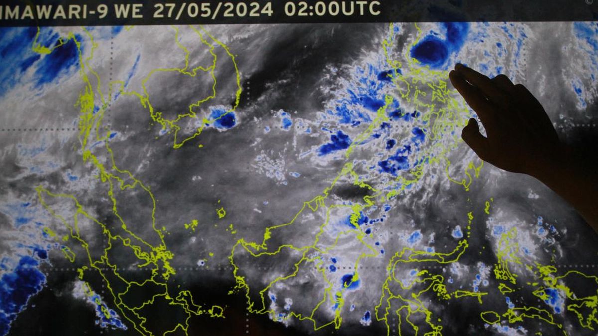
Tropical Cyclone Seed 96W first emerged on May 12, 2026, at 01:00 Western Indonesian Time (WIB), within the designated monitoring zone of TCWC Jakarta. Subsequent analysis conducted on the same day at 07:00 WIB revealed its central circulation positioned approximately at 9.6° North Latitude and 139.4° East Longitude, deep within the Pacific Ocean north of Papua. At this initial stage, the system exhibited maximum sustained winds reaching 20 knots (equivalent to approximately 37 kilometers per hour) within its eastern quadrant, accompanied by a minimum central atmospheric pressure of 1007 hectopascals (hPa).
Satellite imagery observed over the preceding 12 hours indicated a fluctuating pattern in the system’s convective activity, with a noticeable decrease in intensity since 04:00 WIB. However, meteorologists noted a robust distribution of convective clouds, organized into a dense overcast structure, suggesting a well-defined, albeit fluctuating, system. Critically, deep convection, the powerful updrafts that fuel tropical disturbances, was observed to be regenerating on the morning of May 12, specifically to the north of the system’s core. Further analysis of the wind profiles across various atmospheric layers confirmed the presence of a cyclonic circulation from the surface up to the 850 hPa level, although it remained somewhat diffuse and expansive.
Understanding Tropical Cyclone Seeds and Their Formation
A "tropical cyclone seed" (Bibit Siklon Tropis) is a meteorological term used to describe an organized system of clouds and thunderstorms that has the potential to develop into a tropical cyclone. These systems are characterized by a rotating circulation at lower atmospheric levels but have not yet reached the sustained wind speeds (typically 34 knots or 63 km/h) or the clear eye feature required to be classified as a tropical depression, storm, or full-fledged cyclone. Monitoring these seeds is paramount because even without full cyclogenesis, they can generate hazardous weather conditions, including heavy rainfall, strong winds, and dangerous sea states.
The formation of such systems is contingent upon a complex interplay of atmospheric and oceanic conditions. Several key factors were identified as supporting the development of Tropical Cyclone Seed 96W. These include the active presence of Equatorial Rossby Waves, large-scale atmospheric waves that can help organize convection and facilitate cyclonic rotation in the tropics. The sea surface temperatures (SST) in the region were notably warm, ranging between 28-30°C. These elevated temperatures are critical, as warm ocean waters provide the latent heat and moisture necessary to fuel the convective processes within a developing tropical system. The relative humidity was also high, particularly from the surface up to the 700 hPa level, ensuring ample moisture supply. Furthermore, strong upper-level divergence, which helps ventilate the storm and remove rising air, along with supportive vorticity at the 850 hPa level (indicating rotational motion), contributed to the system’s organization. Finally, weak vertical wind shear (5-15 knots), which refers to the change in wind speed or direction with altitude, allowed the system’s vertical structure to remain relatively intact, hindering disruption from stronger winds aloft.
Despite these favorable conditions, several inhibiting factors were also observed, preventing a more rapid or robust development of the system. These included weak lower-layer convergence, meaning insufficient inflow of air towards the center of the system, which is vital for sustained intensification. The presence of dry air in the surrounding environment, particularly at and above the 500 hPa level, also acted as a deterrent, as dry air can suppress convection and weaken the storm’s structure. Lastly, a lack of strong wind supply directed towards the system further limited its ability to consolidate and intensify. This delicate balance of fostering and inhibiting conditions determines the fate of a tropical cyclone seed.
Forecast and Trajectory of Tropical Cyclone Seed 96W
Based on BMKG’s predictive models, Tropical Cyclone Seed 96W is anticipated to remain persistent in its current state over the next 24 hours. The maximum wind speed is projected to hold steady at approximately 20 knots, with a slight decrease in minimum atmospheric pressure to 1006 hPa, indicating a minor strengthening or consolidation. The system is expected to track towards the northwest, reaching an approximate position of 10.0° North Latitude and 137.7° East Longitude.
However, the longer-term outlook suggests a weakening trend for the system. Within the subsequent 48 hours, BMKG forecasts a deceleration in its development, characterized by a further weakening of its circulation and a reduction in maximum wind speeds. Consequently, the overall probability of Tropical Cyclone Seed 96W intensifying into a full-fledged tropical cyclone within the next 24 to 48 hours is assessed as low. This assessment is largely attributed to the persistent inhibiting factors, such as the dry air intrusion and weak lower-level convergence, which are expected to continue suppressing any significant intensification. While the immediate threat of cyclogenesis remains low, the indirect impacts associated with such a system necessitate ongoing vigilance.
Potential Impacts and Preparedness Measures
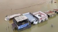
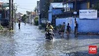
Despite its low probability of developing into a full tropical cyclone, Tropical Cyclone Seed 96W still poses indirect threats, particularly to maritime activities and coastal communities in its vicinity. The primary concern is the potential for elevated sea waves. BMKG has issued warnings for moderate sea waves, ranging from 1.25 to 2.5 meters, in several key maritime zones. These areas include the northern part of the Maluku Sea and the expansive Pacific Ocean north of Maluku extending towards Papua.
Such wave heights can be hazardous for small fishing vessels, inter-island transportation, and other maritime operations. Fishermen are strongly advised to exercise extreme caution or, if necessary, to postpone their activities until conditions improve. Larger commercial shipping might also experience disruptions or require route adjustments to avoid rough seas. Beyond the immediate maritime hazards, persistent strong winds and heavy rainfall, typical accompanying features of tropical disturbances, although not explicitly detailed in the cyclogenesis forecast, could still affect coastal areas. This could lead to localized flooding, coastal erosion, and potential damage to vulnerable infrastructure.
In anticipation of these potential impacts, various government agencies and local authorities are expected to heighten their preparedness. The National Disaster Management Agency (BNPB) and local Provincial/District Disaster Management Agencies (BPBD) would typically issue advisories to communities in vulnerable coastal regions, emphasizing the importance of staying informed through official channels. Maritime authorities, including the Ministry of Transportation, would reinforce warnings to all sea users, ensuring compliance with safety protocols. Local governments in Papua and Maluku would be tasked with monitoring local conditions, activating emergency response protocols if necessary, and disseminating information to their constituents, particularly those in remote island communities heavily reliant on sea transport.
Broader Context: Indonesia’s Vulnerability and Meteorological Expertise
Indonesia, an archipelagic nation with vast maritime territories, is inherently vulnerable to various meteorological phenomena. While situated near the equator, which typically experiences minimal Coriolis effect required for strong cyclonic rotation, the country’s eastern regions, particularly those bordering the Pacific Ocean, are not entirely immune to tropical disturbances. Historical records, though sparse for direct cyclone landfalls, show that tropical systems forming in adjacent basins can bring significant indirect impacts, as evidenced by events like Tropical Cyclone Seroja in 2021, which caused widespread devastation in East Nusa Tenggara.
BMKG’s role as Indonesia’s primary meteorological authority is central to managing these risks. Its TCWC Jakarta operates as part of a global network of warning centers under the World Meteorological Organization (WMO). This center utilizes sophisticated tools, including high-resolution satellite imagery (such as from Himawari-8), advanced numerical weather prediction models (like GFS, ECMWF, and local INA-NWP models), and real-time observational data from buoy networks and weather stations. This comprehensive approach allows for continuous, detailed monitoring of atmospheric conditions, enabling timely alerts and forecasts for phenomena like Tropical Cyclone Seed 96W.
The consistent monitoring and public dissemination of information by BMKG are crucial for fostering a culture of preparedness. By understanding the characteristics of these systems – from their genesis as "seeds" to their potential evolution or dissipation – communities can take proactive measures to protect lives and livelihoods. The incident of Tropical Cyclone Seed 96W serves as a reminder of the dynamic nature of tropical weather patterns and the imperative for robust early warning systems and coordinated disaster risk reduction strategies across the Indonesian archipelago.
Climate Change and Future Implications
The emergence of tropical disturbances like Seed 96W also brings into focus the broader context of climate change. Scientific consensus indicates that rising global sea surface temperatures, a direct consequence of climate change, could potentially influence the frequency, intensity, and geographical distribution of tropical cyclones worldwide. Warmer oceans provide more energy for storms, potentially leading to more rapid intensification or sustaining systems for longer periods. While it is challenging to attribute any single weather event directly to climate change, the increased monitoring of such seeds becomes even more critical in a warming world.
For Indonesia, this implies a continuous need to invest in advanced meteorological infrastructure, enhance climate resilience in coastal areas, and adapt disaster management strategies to account for potentially shifting patterns of extreme weather events. The vigilance demonstrated by BMKG in tracking Tropical Cyclone Seed 96W is not merely an immediate response to a weather anomaly but an integral part of a long-term strategy to safeguard Indonesia against the evolving challenges of a changing climate. The lessons learned from monitoring systems like 96W contribute valuable data to global climate research and inform national policies on environmental protection and disaster preparedness.


