Jakarta Governor Pramono Anung Accelerates Comprehensive River Normalization Projects Across the Capital Ahead of Anticipated Heavy Rains

The Jakarta Provincial Government has aggressively ramped up its flood mitigation infrastructure projects, placing primary emphasis on the extensive normalization of major rivers, local tributaries, and urban drainage networks. With the looming transition into the annual wet season, Governor Pramono Anung has taken a direct, hands-on approach by inspecting critical water management sites across the metropolitan area. The strategic acceleration of these engineering works reflects the administration’s acute awareness of Jakarta’s historical vulnerability to seasonal flooding, a persistent urban crisis that routinely threatens residential communities, disrupts local commerce, and strains municipal emergency services.
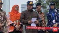
This strategic push was underscored during Governor Pramono’s official field inspection at the Mampang River normalization project, specifically focusing on the Poncol segment located in West Kuningan, South Jakarta. Speaking to members of the press during the site visit, the Governor outlined the broad geographical scope of the current mitigation campaign, emphasizing that multiple key waterways are simultaneously undergoing structural rehabilitation and hydraulic capacity expansion to handle projected surges in precipitation.
The Comprehensive Scope of Jakarta’s River Normalization and Drainage Rehabilitation
Addressing reporters at the Mampang River project site, Governor Pramono detailed the multi-pronged engineering approach being deployed across the capital’s complex watershed network. The ongoing interventions are not isolated to a single water channel but represent a synchronized effort targeting several high-risk hydrological zones throughout the Special Region of Jakarta.
"Normalisasi sungai, baik di Ciliwung, Krukut, Cakung Lama, kemudian juga Mampang, walaupun Mampang ini pendek, itu kita lakukan dengan harapan bahwa persiapan untuk menghadapi hujan di Jakarta," stated Governor Pramono during his inspection of the West Kuningan location, highlighting the strategic importance of both major arterial rivers and shorter, highly responsive local tributaries.
The Ciliwung River, historically recognized as Jakarta’s primary flood artery originating from the mountainous regions of Bogor, remains a central focus of structural widening and embankment reinforcement. Concurrently, other vital waterways such as the Krukut River and the Cakung Lama channel are undergoing intensive dredging to remove accumulated sediment, silt, and municipal waste that severely restrict natural water flow. Even shorter watercourses, such as the Mampang River segment, are receiving targeted engineering interventions due to their critical role in draining densely populated urban neighborhoods.
Historical Context of Jakarta Flooding and the Chronic Vulnerability of the Mampang Basin
Flooding has long been established as an intractable structural challenge for Jakarta, an expansive delta city characterized by low-lying topography, rapid and extensive land subsidence, and an overwhelming volume of runoff generated by torrential tropical downpours. The hazard profile of the capital becomes particularly pronounced during the transition from the dry season to the monsoon period, drawing intense scrutiny from urban planners, environmental experts, and the general public alike.
The Mampang River basin serves as a textbook example of this chronic urban vulnerability. Due to rapid historical urbanization, narrowing river profiles, and soil compaction, the area has transformed into a high-risk flood zone where even moderate weather events can trigger immediate inundation. Governor Pramono explicitly acknowledged the severe limitations of the current basin capacity and the persistent distress experienced by local residents who bear the brunt of seasonal weather extremes.
"Tempat ini yang merupakan tempat yang dari waktu ke waktu, terus terang ini adalah, hujannya 100 mm per hari aja pasti banjir dan banyak keluhan yang datang dari masyarakat di sini mengenai banjir," the Governor explained, emphasizing that a rainfall threshold of merely 100 millimeters per day is sufficient to overwhelm the existing drainage infrastructure and force water into surrounding streets and homes.
Timeline and Meteorological Projections for the Upcoming Wet Season
Urban planning and disaster mitigation strategies in Jakarta operate under tight meteorological schedules. According to current projections provided by the Meteorology, Climatology, and Geophysical Agency (BMKG), cited by the provincial administration, the upcoming rainy season for the 2026 cycle is anticipated to commence toward the latter half of November.
This impending timeline has compressed the operational window for municipal public works agencies, turning the mitigation campaign into an urgent race against time. The administration has explicitly recognized that proactive intervention during the dry months is exponentially more effective than reactive emergency response after severe flooding has already occurred. Consequently, municipal engineering crews have been directed to operate at maximum capacity while favorable weather conditions persist, capitalizing on the extended dry spell to complete high-impact infrastructure maintenance.
Leveraging Extended El Nino Conditions for Rapid Infrastructure Rehabilitation
Ironically, regional climatic anomalies have provided a temporary operational advantage for the Jakarta Provincial Government. The extended dry weather patterns associated with the El Nino phenomenon have created prolonged periods of low precipitation, which municipal authorities have aggressively utilized to execute heavy civil engineering works that are otherwise nearly impossible to perform during wet conditions.
Governor Pramono highlighted that this extended dry window has been designated as a critical period for structural remediation across all municipal water assets. "El Nino yang panjang ini kita persiapkan untuk melakukan perbaikan fasilitas yang dimiliki Pemerintah DKI Jakarta menangani banjir," he remarked, noting that the administration is systematically addressing years of deferred maintenance and administrative backlogs that previously hindered comprehensive river care.
The comprehensive rehabilitation agenda extends far beyond basic river dredging. The provincial government has operationalized a four-pillar mitigation strategy designed to capture, retain, and redirect excess stormwater before it can accumulate in residential and commercial districts:
- River Normalization and Widening: Reclaiming natural river widths, removing illegal structural encroachments along embankments, and constructing robust concrete sheet-pile retaining walls to prevent erosion and structural collapse.
- Construction and Expansion of Retention Basins (Embung): Building artificial lakes and water storage reservoirs in strategic low-lying areas to temporarily hold excess runoff and regulate peak discharge rates into primary rivers.
- Comprehensive Drainage and Culvert Dredging: Systematically clearing millions of meters of urban drainage channels, neighborhood culverts, and secondary canals clogged with sediment and domestic waste.
- Hydraulic Junction Optimization: Redesigned and upgraded convergence points where secondary tributaries meet primary rivers to eliminate hydraulic bottlenecks that historically caused severe backflow and localized flooding.
"Normalisasi yang sudah begitu lama tidak pernah dilakukan, sekarang kita lakukan kembali. Semua selokan-selokan, sungai-sungai kita lakukan apa pengerukan di mana-mana," Governor Pramono emphasized, signaling a decisive shift toward continuous, institutionalized preventative maintenance rather than sporadic, post-disaster clean-up efforts.
Anticipated Impacts and Analytical Implications for Metropolitan Resilience
The aggressive scaling up of Jakarta’s flood mitigation infrastructure carries profound implications for the socio-economic stability of the capital. Urban economists and civil engineers have long noted that chronic flooding inflicts multi-billion-rupiah losses on Jakarta’s economy annually, damaging commercial assets, disrupting supply chains, impairing public transportation networks, and posing severe public health risks due to waterborne diseases.
By systematically addressing choke points in the Mampang, Ciliwung, Krukut, and Cakung Lama watersheds, the Jakarta Provincial Government aims to achieve a measurable reduction in both the frequency and volumetric scale of flood events during the upcoming rainy season. While engineering experts universally acknowledge that a city of Jakarta’s topographical complexity can never achieve absolute flood immunity, strategic normalization and enhanced retention capacity are proven catalysts for significantly shortening inundation periods and minimizing property damage.
Furthermore, the current administration’s emphasis on proactive inter-agency coordination and the maximization of the dry-season working window reflects an evolving maturity in urban disaster risk management. As climate change continues to increase the frequency and intensity of extreme weather events across Southeast Asia, the success of Jakarta’s modernized flood control infrastructure will serve as a vital benchmark for other metropolitan centers facing similar geographical and hydrological challenges.
As the late-November deadline for the onset of the wet season approaches, the citizens of Jakarta watch closely as heavy machinery continues to reshape the banks of the capital’s rivers. The ultimate test of these accelerated normalization projects will arrive with the first major downpours, where the restored carrying capacity of channels like the Mampang and Ciliwung rivers will determine whether the administration’s proactive investments successfully shield the metropolis from its historic nemesis.
Related posts: